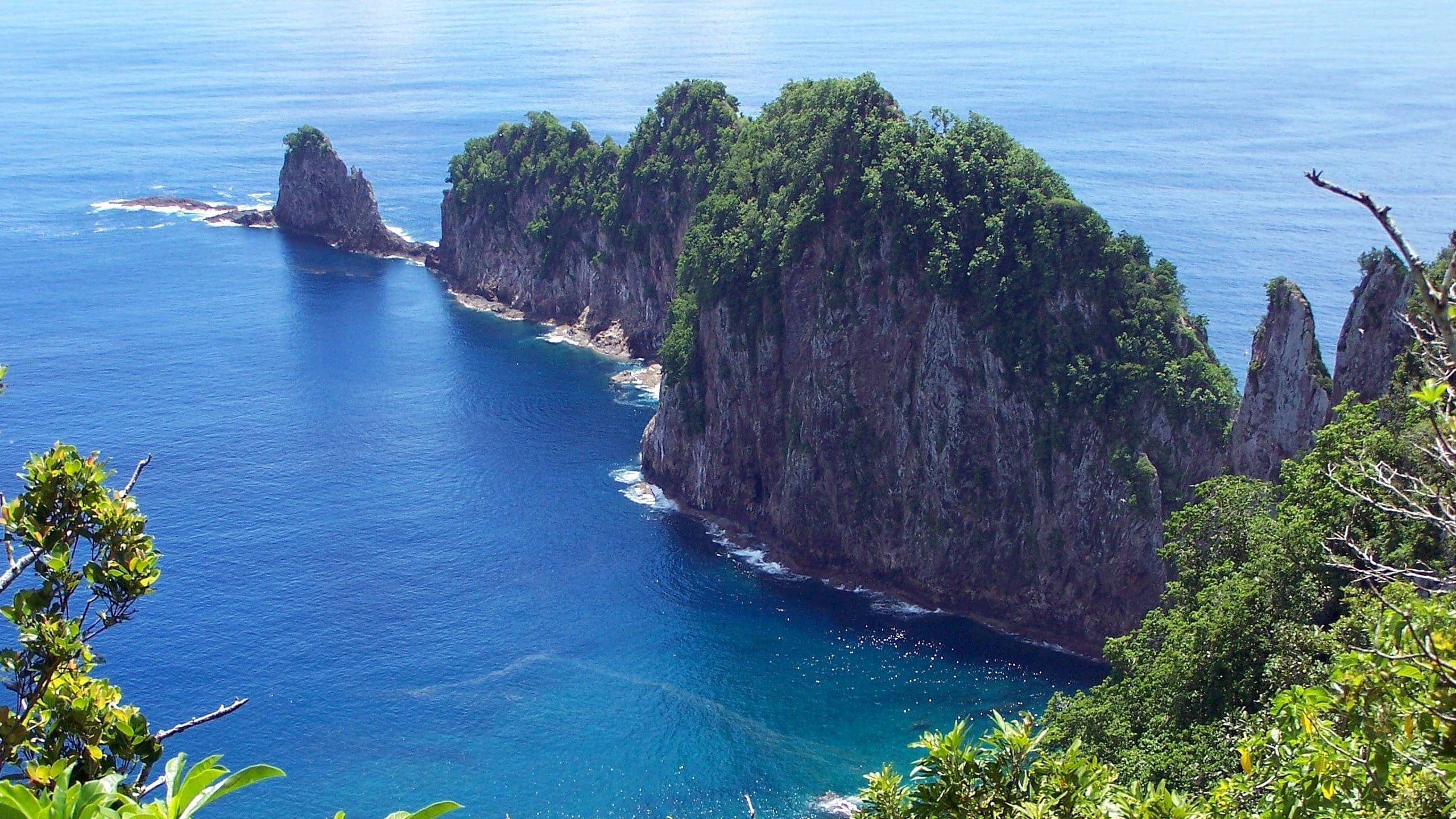
About National Park of American Samoa
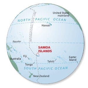
The Samoan Islands are a part of Polynesia and have been inhabited by people for more than 3,000 years. The islands are 2,600 miles southwest of Hawaii, 1,800 miles northeast of New Zealand, and adjacent to the international dateline (see figure 1). Stretching east to west for 300 miles, the Samoan Islands include the U.S. territory of American Samoa and the independent nation of Samoa (formerly Western Samoa) (see figure 2).
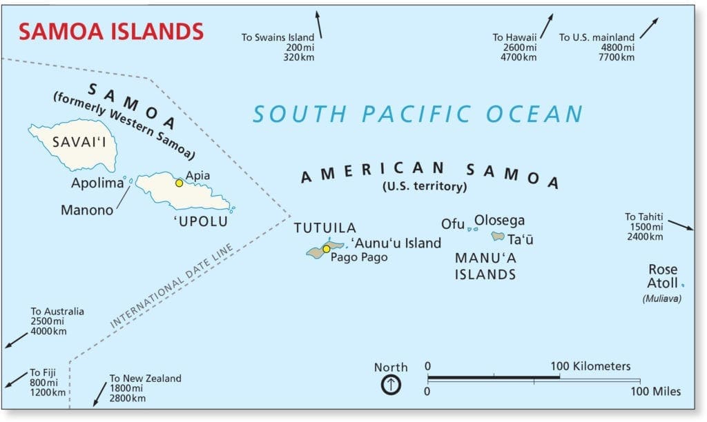
American Samoa, the only U.S. territory south of the equator, consists of five rugged volcanic islands and two coral atolls. From west to east, these islands are Tutuila, its smaller neighbor Aunu’u, and the three islands of the Manu’a Group —Ofu, Olosega, and Ta’ū. The land area is 76 square miles and the population is approximately 55,000 (2010), with most people living on the island of Tutuila.
Oral traditions and archeological evidence support the idea that Samoa is one of the original homelands of the Polynesian people. In American Samoa, 90% of the population is Samoan or other Pacific Islander. Samoan is most islanders’ first language and they live the Fa‘asamoa—the customs, beliefs, and traditions of the Samoan culture. Many Samoans still live interconnected with their environment and use the tropical rainforests, coral reefs, and the ocean for subsistence and cultural practices.
In 1988, the National Park of American Samoa was authorized to:
“…preserve and protect the tropical forest and archeological and cultural resources of American Samoa, and of associated reefs, to maintain the habitat of flying foxes, preserve the ecological balance of the Samoan tropical forest, and, consistent with the preservation of these resources, to provide for the enjoyment of the unique resources of the Samoan tropical forest by visitors from around the world.”
The National Park of American Samoa has three separate units on the islands of Tutuila, Ofu, and Ta’ū. The park’s 6,303 acres of land and 2,800 acres of water contain wild, scenic paleotropical rainforest, coastal areas, and coral reef environments. American Samoa’s paleotropical rainforest is composed of plants and animals from the “Old World” ecosystems of Southeast Asia (predominantly Indonesia), as opposed to the distant Americas. The park contains a wealth of important cultural resources that have strong connections to past and present Samoan people.
The park’s land base was established in September 1993 when a lease agreement was signed between the American Samoa Government and the National Park Service. The park is unique in the national park system in that all the land is owned by individual villages and leased to the National Park Service. The lands designated in the enabling legislation are within the villages of Fitiuta, Faleasao, Ta’u, Olosega, Ofu, Afono, Vatia, PagoPago and Fagasa. The current 50- year lease represents an experiment between two very different land tenure philosophies—the South Seas matai communal land arrangement kept by oral tradition and custom and the English surveyed, deeded, written, and recorded system.
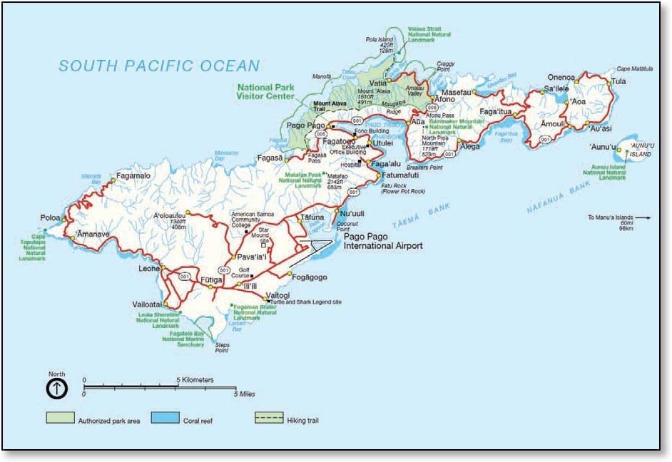
The Tutuila unit of the National Park of American Samoa is the most accessible unit of the park and comprises approximately 2,500 acres of land and approximately 1,200 acres of offshore waters (see figure 3). The park encompasses entire watersheds from some of the highest points in American Samoa to the coastlines and marine areas. Here and throughout the islands, the tropical rainforests cover steep slopes of the islands from the waterline to the tops of the mountains. Twenty-one acres at the summit of Mt. Alava, including the upper terminal of the aerial tramway, power poles, transformer, and TV transmitter, are owned by the American Samoa Government and are excluded from the park’s lease.
The Ta’ū unit is about 60 miles east of the island of Tutuila, comprising approximately 3,700 acres of land and approximately 1,100 acres of offshore waters (see figure 4). Samoans believe the sacred site of Saua on Ta’ū is the birthplace of all Polynesia. Beyond Saua around Si’u Point is the dramatic southern coast, where waves crash against the rocky coast and sea cliffs stairstep to the summit of Lata Mountain—the highest point in American Samoa at 3,170 feet/966 meters.
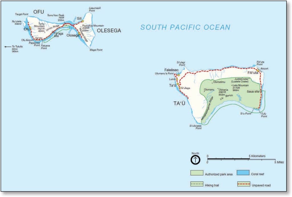
On Ofu island, about 10 miles northwest of Ta’ū, is the Ofu unit of the national park (see figure 4). This is the smallest unit with about 70 acres of land and approximately 400 acres of offshore waters. The island’s coral reefs are healthy, diverse, and an outstanding example of South Pacific marine habitat. With its remoteness, the 2 mile beach in the park can be enjoyed with few, if any, other people.
Source: Foundation Document – National Park of American Samoa
Enjoy this unique national park and the welcoming people of American Samoa. We are here to protect its rich culture and natural resources. Come explore them with us! | National Park of American Samoa | | https://www.nps.gov/npsa/index.htm
Fast Facts:
| Date the Park was Established: | October 31, 1988 |
| Park Area (as of 2019): | 8,256.67 acres (33.4 km2) |
| Recreational Visitors (2018 Total): | 28,626 visitors |

