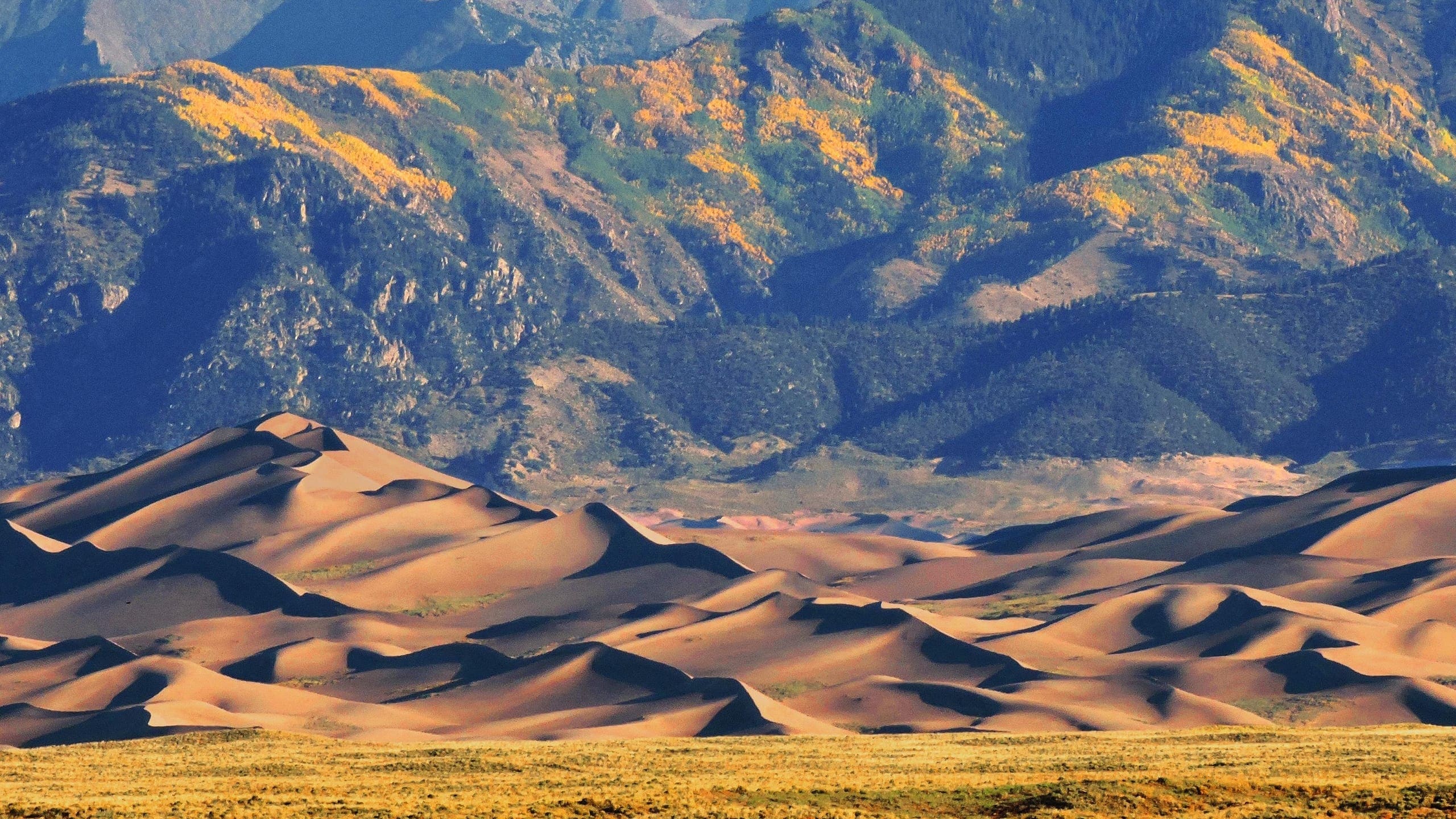
About Great Sand Dunes National Park & Preserve
Great Sand Dunes National Park and Preserve is in the San Luis Valley of south-central Colorado at an elevation of 8,175 feet. The dunes lie on the eastern edge of the valley at the base of the Sangre de Cristo Range. The dunefield is part of the nearly 150,000 total acres of the park and preserve that also protects alpine lakes, tundra, six peaks over 13,000 feet, ancient spruce and pine forests, large stands of aspen and cottonwood, grasslands, and wetlands.
The park is part of a fragile, dynamic system that influences and sustains the tallest dunes in North America. The dunefield, roughly 30 square miles, is a huge deposit of pure, fine-grained sand nestled against the mountains. It sits between Sand and Medano Creeks, which carry sand from the east and north sides of the dunefield and redeposit it where southwesterly winds can transport it back to the dunefield, which is constantly being shaped by wind. The sand sheet surrounds the dunefield and is stabilized by grasses and other low-growing plant life.
The sabkha (a sand deposit hardened by minerals) is west of the sand sheet and is cemented by minerals deposited by seasonal wetlands. Streams originating from high alpine lakes in the adjacent Sangre de Cristo Range recycle wind-blown sand back to and around the dunes and feed underground aquifers. Over time, sand, wind, and water combine and join forces to shape the ever-changing dunefield.
A dramatic diversity of healthy life zones, supported by a lack of artificial noise and light, provides distinct communities of plant and animal life. Just above the dunefield, at the base of the mountains, short shrubs give way to sparse pinyon-juniper woodland. With rising elevation, the pinyon-juniper forest transitions into denser mountain forests of fir, pine, and aspen. Higher still is the subalpine life zone, where hardy stands of spruce and fir mingle with rocky talus slopes. Forest communities of bristlecone and limber pine grow on rocky ridges and outcrops where other tree species are unable to thrive. Near the crest of the mountains is the rocky, snowy alpine zone.
American Indian groups hunted and used wild plant resources near the Great Sand Dunes as early as 10,000 to 12,000 years ago. Through time, the region appears to have been continuously used on an intermittent basis because of its reliable water and plentiful food resources. Beginning around AD 1400 Indian groups that we now know as Apaches, Arapahos, Cheyennes, Comanches, Kiowas, Navajos, and Utes seasonally used the San Luis Valley and its abundant resources.
The Spanish arrived in the San Luis Valley in the late 1500s and their cultural influence remains today. In 1807, explorer Zebulon Pike and his men climbed over the crest of the Sangre de Cristo Range and into the valley. Miners, homesteaders, ranchers, farmers, and migrant workers labored in this valley over the years. In the 1920s, local pride and income from tourists encouraged residents of the area to press for national monument status, which came to pass in 1932. A congressional act in 2000 expanded the monument to a national park and preserve.
Visitors experience sand, sun, wind, and water in this land of elemental contrasts. At the foot of the dunes, Medano Creek’s surging waters provide a delightful contrast to the barren sand surface in the spring and early summer. In addition to the dunes, visitors can enjoy mountain forests, expansive grasslands, wildlife viewing, stargazing, and surprisingly accessible designated wilderness opportunities.
Source: Foundation Document Overview – Great Sand Dunes National Park
Fast Facts:
| Date the Park was Established: | September 13, 2004 |
| Park Area (as of 2019): | 107,341.87 acres (434.4 km2) |
| Recreational Visitors (2018 Total): | 442,905 visitors |


