Grand Canyon National Park Maps & Documents
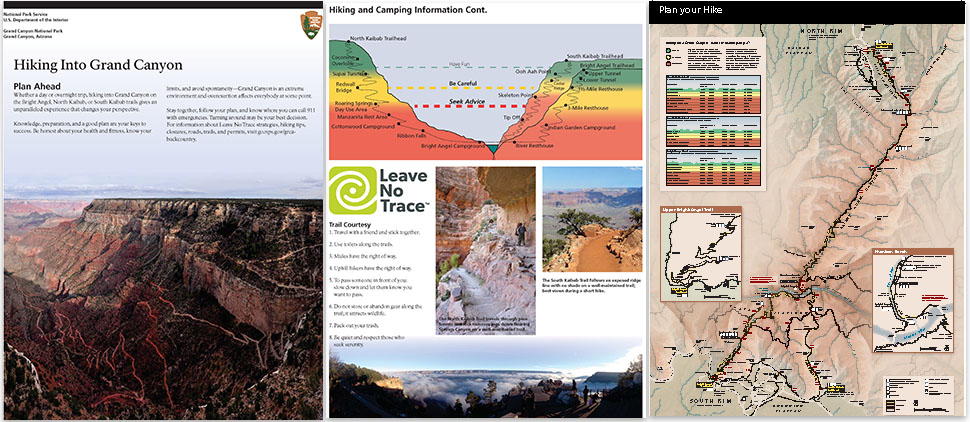
3 Pages Of The Introduction Of The Backcountry Hiking Brochure: Title Page, Trails Profile, Corridor Trails Map
3 pages of the Introduction of the Backcountry Hiking Brochure: title page, trails profile, Corridor Trails Map
Map file from NPS.gov/grca/ website
179.24 KB
3D Park Map
From park brochure
2018 screen-viewable file
662.22 KB
2018 screen-viewable file
47.14 MB
2018 print production files with shaded relief
105.82 MB
*downloads in a Zip file.
A Map Showing The Grand Canyon Village Area On The Left, With The 23 Mile Desert View Drive Drawn From Left To Right And Ending At The Desert View Settlement On The Right.
a map showing the Grand Canyon Village Area on the left, with the 23 mile Desert View Drive drawn from left to right and ending at the Desert View settlement on the right.
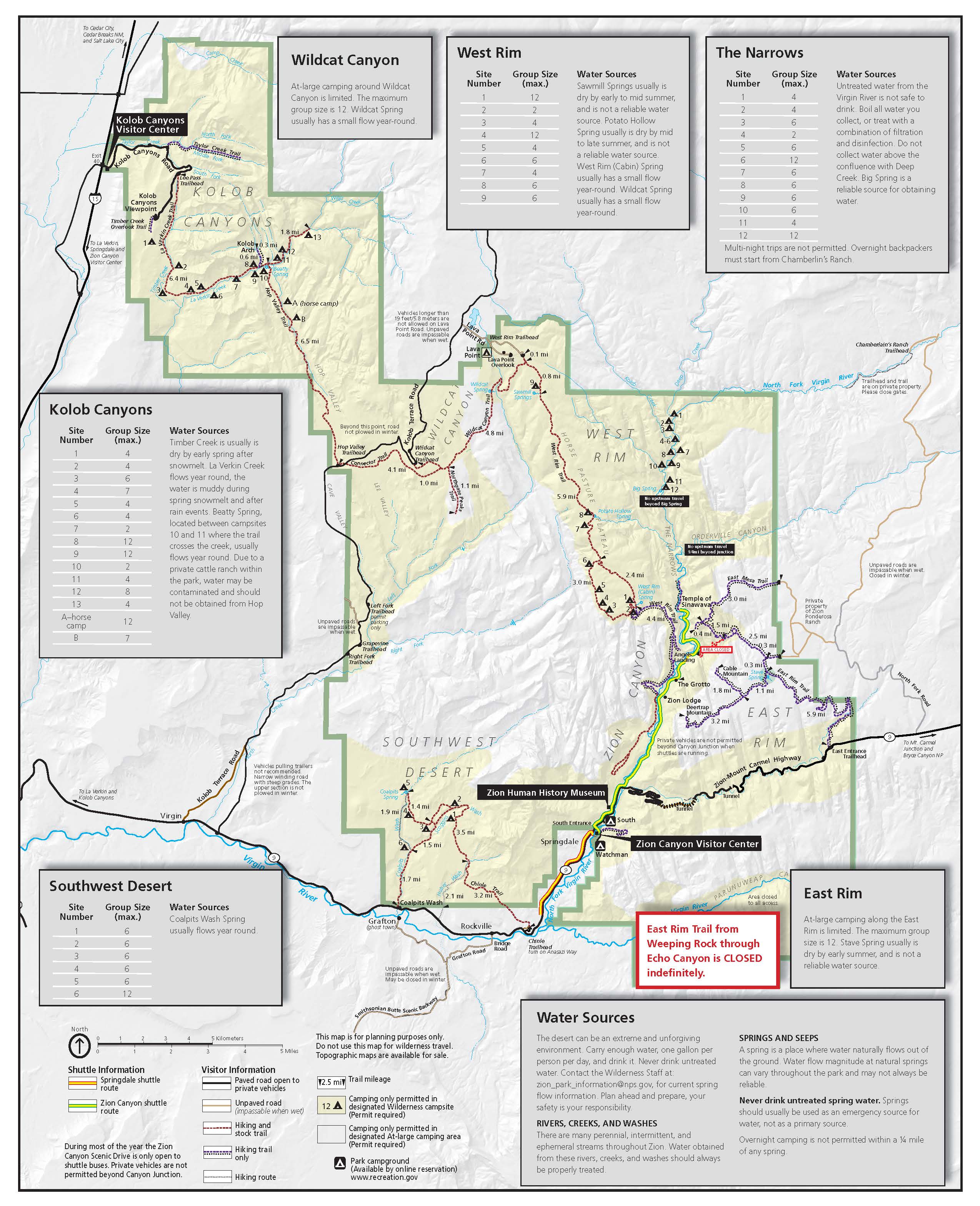
Map file from NPS.gov/zion/ website
830.98 KB
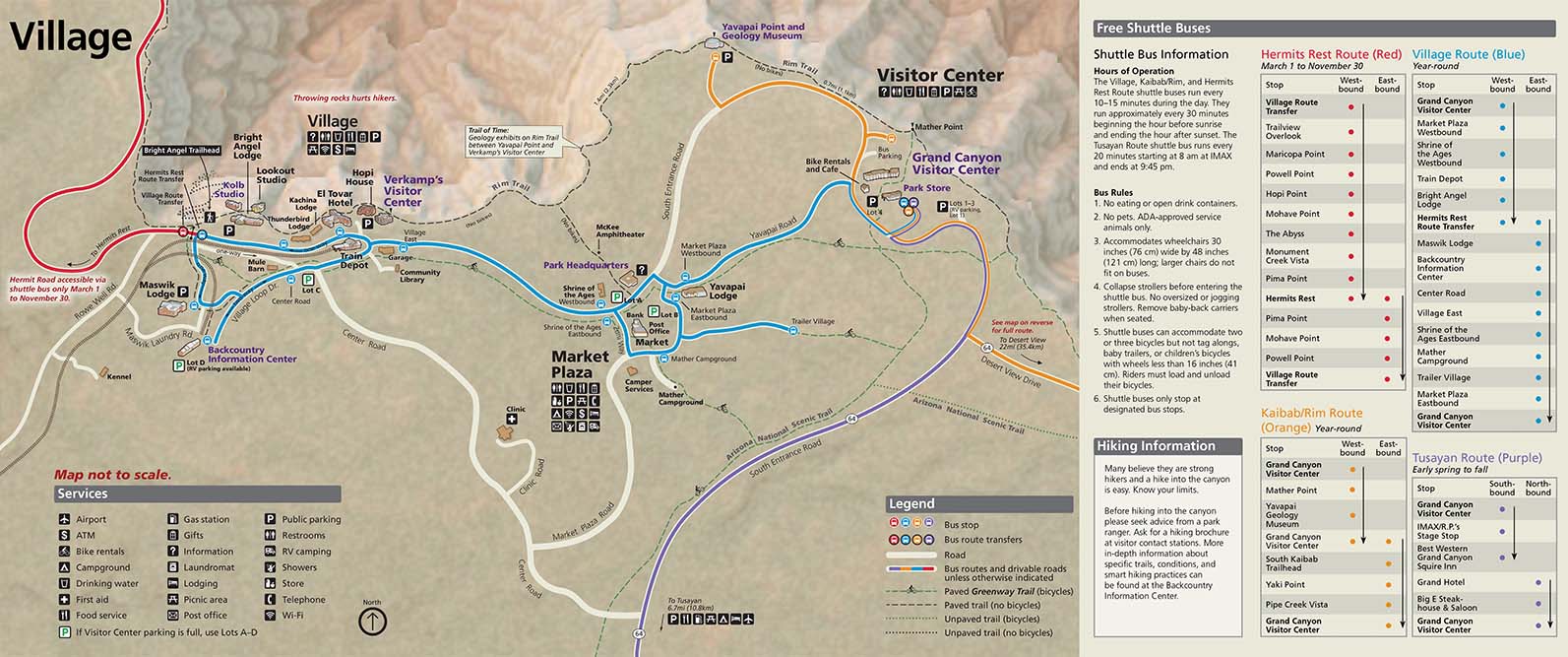
A Portion Of The South Rim Pocket Map That Shows Grand Canyon Village With Shuttle Bus Routes As Colored Lines. On The Right; Shuttle Bus Information And Schedules.
a portion of the South Rim Pocket Map that shows Grand Canyon Village with shuttle bus routes as colored lines. on the right; shuttle bus information and schedules.
Map file from NPS.gov/grca/ website
202.36 KB
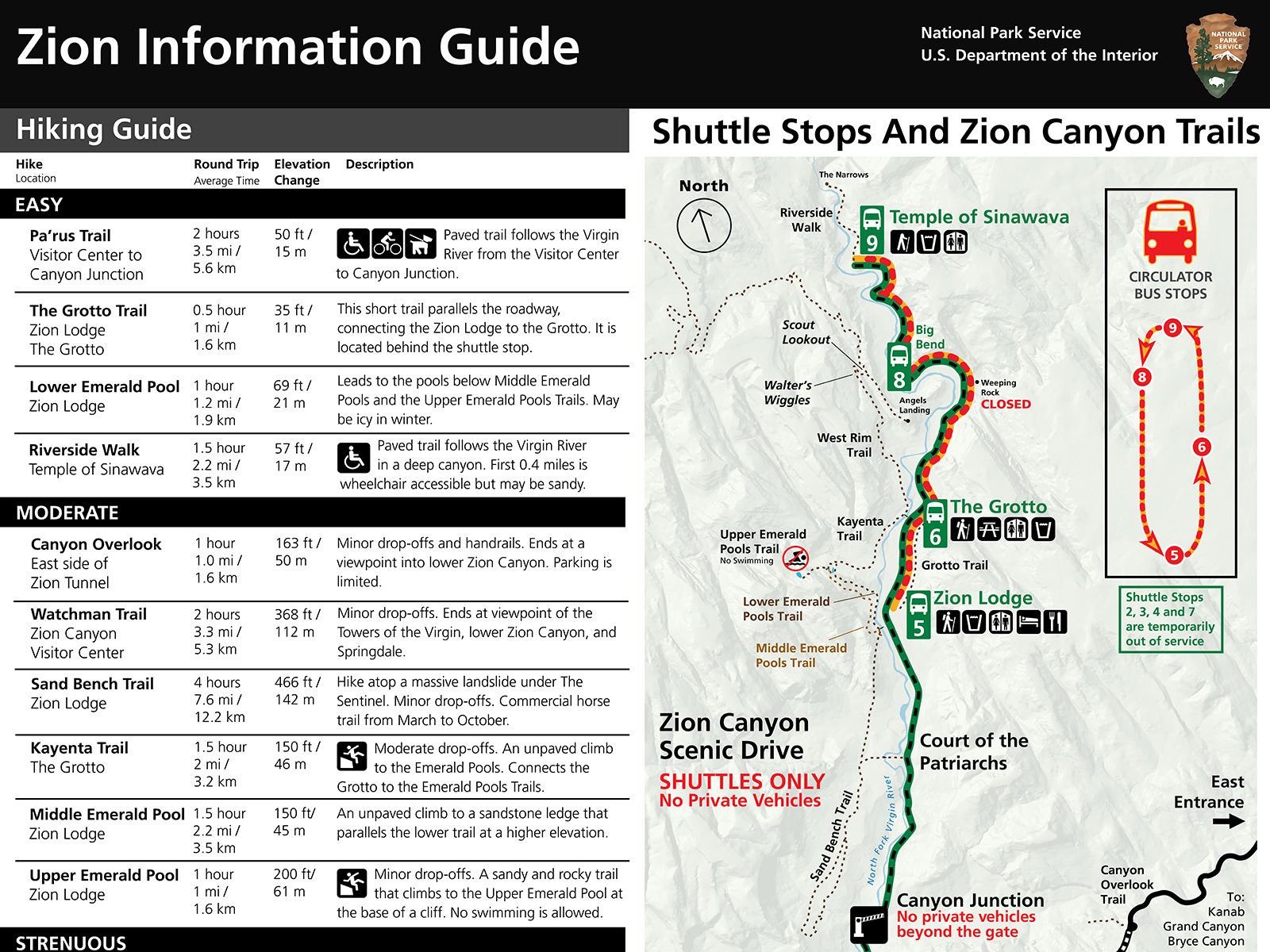
A Red Octagon With The Words STOP In White Letters
a red octagon with the words STOP in white letters
Map file from NPS.gov/zion/ website
111.08 KB
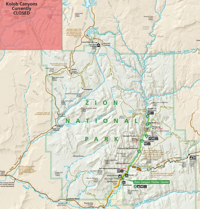
A Section Of A USGS Topo Map That Shows Canyon Cliffs And A Forested Area In Green Above The Canyon
a section of a USGS topo map that shows canyon cliffs and a forested area in green above the canyon
Map file from NPS.gov/zion/ website
1.07 MB
Area Map
From park brochure
JPG Viewable Map File
456.30 KB
November 2012 print production file
1.05 MB
*downloads in a Zip file.
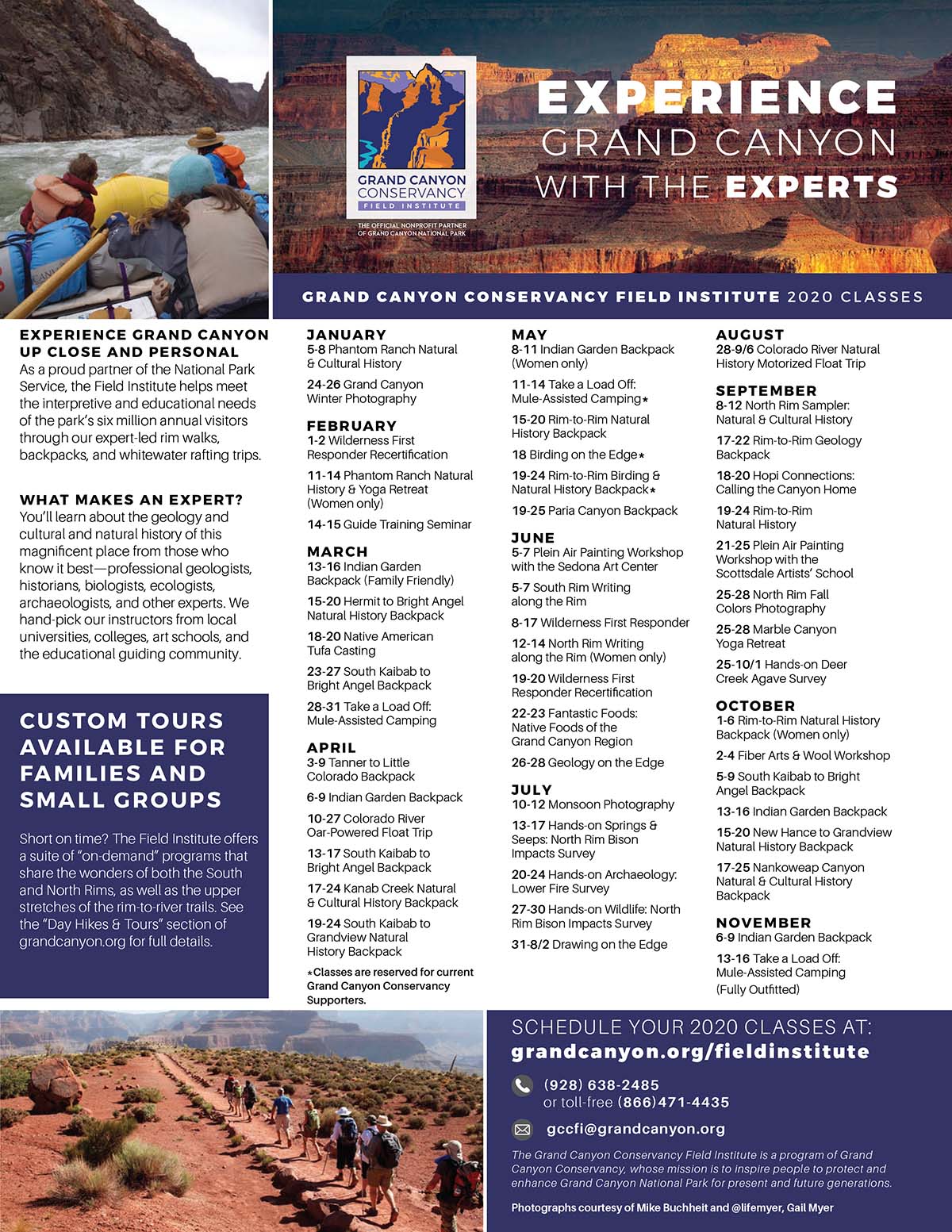
Field Institute Class Schedule Displays 11 Months Of 2020 Class Listing In 3 Columns Of Text. Two Small Photos Illustrate Hiking And Rafting Activities.
Field Institute class schedule displays 11 months of 2020 class listing in 3 columns of text. Two small photos illustrate hiking and rafting activities.
Map file from NPS.gov/grca/ website
404.91 KB
Geologic Diagram
From park brochure
2018 screen-viewable file
215.58 KB
2018 screen-viewable file
3.93 MB
2018 print production file
4.45 MB
*downloads in a Zip file.
Getting Around The North Rim Map
supplemental map
JPG Viewable Map File
6.04 MB
May 2016 PDF screen viewable file
86.99 MB
May 2016 print production file
78.75 MB
*downloads in a Zip file.
May 2016 full resolution shaded relief file
71.00 MB
*downloads in a Zip file.
Getting Around The South Rim Map
supplemental map
JPG Viewable Map File
4.18 MB
May 2016 PDF screen viewable file
17.44 MB
May 2016 print production file
12.77 MB
*downloads in a Zip file.
May 2016 full resolution shaded relief file
10.04 MB
*downloads in a Zip file.
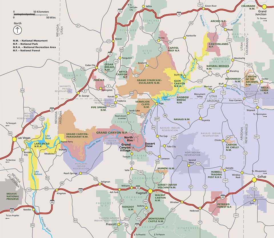
Grand Canyon Area Map: Shows Major Highways And Public Lands.
Grand Canyon Area Map: Shows major highways and public lands.
Map file from NPS.gov/grca/ website
133.76 KB
Grand Canyon Hiking Map
Supplemental map
JPG Viewable Map File
6.64 MB
May 2017 geospatial PDF screen viewable file
42.76 MB
May 2017 print production file
102.39 MB
*downloads in a Zip file.
May 2017 full resolution shaded relief file
63.88 MB
*downloads in a Zip file.
Grand Canyon Panorama Map: South Rim In Foreground, Canyon In Shaded Relief And North Rim At The Top.
Grand Canyon Panorama Map: South Rim in foreground, canyon in shaded relief and North Rim at the top.
Map file from NPS.gov/grca/ website
402.20 KB
Graphic Of A Person's Head That Is Wearing A Face Mask Within A Square Frame.
graphic of a person's head that is wearing a face mask within a square frame.
Map file from NPS.gov/grca/ website
139.50 KB
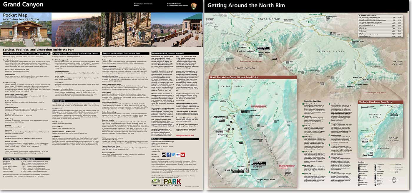
Graphic Shows Front (listing Of Services) And Back (maps) Of North Rim Pocket Map - The PDF Version Is Accessible.
Graphic shows front (listing of services) and back (maps) of North Rim Pocket Map - the PDF version is accessible.
Map file from NPS.gov/grca/ website
164.03 KB
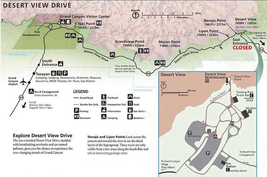
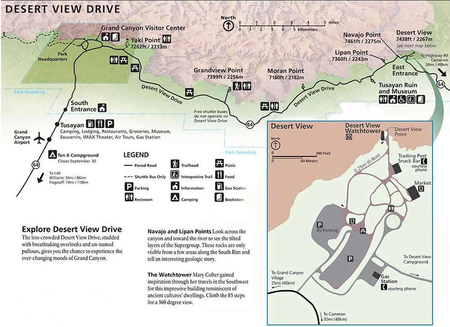
Map Of Desert View Drive On The S.Rim Of Grand Canyon National Park. An Overview Is Positioned At The Top, Showing The Entire 25 Mile Length Of The Drive. On The Right, An Insert Detailing The Buildings And Parking Lots Of The Desert View Area.
Map of Desert View Drive on the S.Rim of Grand Canyon National Park. an overview is positioned at the top, showing the entire 25 mile length of the drive. On the right, an insert detailing the buildings and parking lots of the Desert View area.
Map file from NPS.gov/grca/ website
168.10 KB
Map Of Desert View Drive On The S.Rim Of Grand Canyon National Park. An Overview Is Shown At The Top, Showing The Entire Length Of The Drive. On The Right, An Insert Of The Desert View Developed Area.
Map of Desert View Drive on the S.Rim of Grand Canyon National Park. an overview is shown at the top, showing the entire length of the drive. On the right, an insert of the Desert View developed area.
Map file from NPS.gov/glba/ website
44.73 KB
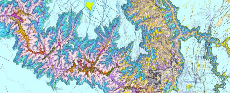
Multicolored Map Represents Grand Canyon Rock Types And Strata In A Variety Of Colors.
Multicolored map represents Grand Canyon rock types and strata in a variety of colors.
Map file from NPS.gov/grca/ website
94.07 KB
North Rim Detail Map
From park brochure
JPG Viewable Map File
2.07 MB
October 2012 print production file
4.01 MB
*downloads in a Zip file.
October 2012 shaded relief file
3.06 MB
*downloads in a Zip file.
Park Map
Park map
JPG Viewable Map File
5.83 MB
June 2014 print production file
50.46 MB
*downloads in a Zip file.
June 2014 full-resolution relief file
41.48 MB
*downloads in a Zip file.
South Rim Grand Canyon Village Detail Map
From park brochure
JPG Viewable Map File
1.48 MB
October 2012 print production file
15.45 MB
*downloads in a Zip file.
November 2011 shaded relief file
12.87 MB
*downloads in a Zip file.
South Rim Panorama Map
From park brochure
JPG Viewable Map File
7.35 MB
October 2012 print production file
976.56 KB
*downloads in a Zip file.
October 2012 shaded relief file
61.23 MB
*downloads in a Zip file.
Three Mobile Phones Side-by-side, Are Displaying Screens From The NPS Mobile App; The Menu, Map, And Search.
three mobile phones side-by-side, are displaying screens from the NPS mobile app; the menu, map, and search.
Map file from NPS.gov/whsa/ website
11.73 KB
