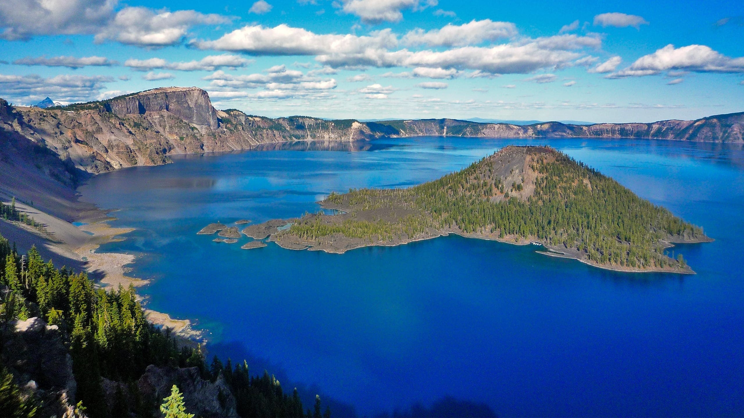
About Crater Lake National Park
Crater Lake National Park—established in 1902—is in southwest Oregon in the south-central portion of the Cascade Range. The park ranges in elevation from about 3,800 feet to just over 8,900 feet at Mount Scott. Near the center of the park is one of its most spectacular features, Crater Lake. At 1,943 feet deep, it is the deepest lake in the United States. The lake is in a caldera, which was formed when the top of 12,000-foot Mount Mazama erupted and collapsed about 7,700 years ago. Over the centuries, the caldera has collected water from rain and snow to form the lake. The lake is about 5 miles in diameter and is surrounded by the jagged, steepwalled cliffs of the caldera left by the climatic eruption. The cliffs surrounding the lake rise from 500 to 2,000 feet above the lake’s surface.
From the rimmed summit, the land slopes gradually downward in all directions. There are no inlets or outlets to the lake, and evaporation and seepage prevent the lake from becoming deeper. Crater Lake has no influent or effluent streams to provide continuing supplies of oxygen, nutrients, and fresh water and is considered a youthful lake with a high level of purity. The lack of dissolved minerals greatly restricts the growth of aquatic plants and the absence of sufficient carbonates inhibits the development of large-shelled animals. The result is a high level of light penetration that exceeds other alpine lakes. Crater Lake has been the object of scientific study for more than a century.
The park encompasses approximately 182,304 acres and is heavily forested, except for a number of treeless, pumice-covered fats. Streams originating on the slopes of the caldera form headwaters of the Rogue River to the west or join the Klamath Basin to the south and east. Steep-walled canyons cut through pumice and towering fossil fumaroles contribute to the ruggedness of the terrain.
The fora within the national park is typical of the vegetation found throughout the Southern Cascades and ranges from mixed conifer forest dominated by ponderosa pine in the south to high elevation mountain hemlock and whitebark pine forest at the rim. The park is regarded as a sanctuary for native forest and meadow communities.
The park lands are of continuing importance to members of American Indian tribes. Klamath Indian and Umpqua people tell stories of the eruption of Mount Mazama, and artifacts found buried under Mazama ash and pumice are evidence of the great impact the eruption had on people living in the area. Crater Lake was used as a place for vision quests and prayer, and the surrounding areas were used for resource harvesting activities and other cultural traditions. The park is part of a larger cultural landscape that extends well beyond park boundaries. Today, the park is fortunate to have the support of local and regional partners, who contribute to the protection of resources and enhance visitor experiences.
The park’s southern entrance station at Mazama Village is 76 miles from Medford and 56 miles from Klamath Falls and can be reached by Oregon State Route (OR) 62. During summer the park can also be reached from the north by OR 138. Both access roads lead to Rim Drive, a 33- mile roadway that circles the caldera rim. Rim Drive and OR 209, which runs through the park, have been designated as part of the Volcanic Legacy Scenic Byway, and numerous pullouts provide scenic lake views.
The park is one of many opportunities for visitors in the area. Many people stop at the park as part of a north-south trip to various parks and scenic areas in Oregon and Northern California. In recent years park attendance has approached 600,000 and continues to grow. As a leading attraction in Southern Oregon, visitor spending contributes significantly to the regional economy.
Source: Foundation Document – Crater Lake National Park
Fast Facts:
| Date the Park was Established: | May 22, 1902 |
| Park Area (as of 2019): | 183,224.05 acres (741.5 km2) |
| Recreational Visitors (2018 Total): | 720659 visitors |


