Posted: April 1, 2021
Some links provided in this article are affiliate links. Meaning, at no additional cost to you, we’ll earn a commission if you click one and make a purchase. An easy way to help support us if you’re going to buy anyway!
It’s time for our “April 2021 – Park of the Month”! Each month, Discover Our Parks will choose a “Park of the Month” to showcase on our site and why we choose to feature it. We will utilize comments, time of the year and other factors when making our decisions. We might even ask you, our adventurers, which park you think should be next.
Are you apart of the conversations about our Park of the Month’s? Join in on our Discord Server, it’s free!
Without further delay… what park gets April 2021’s “Park of the Month”???
Bryce Canyon National Park
The person most responsible for Bryce Canyon becoming a National Park was J. W. Humphrey. Mr. Humphrey was a U. S. Forest Service Supervisor who was transferred to Panguitch, Utah in July 1915. An employee suggested that J. W. view the eastern edge of the Paunsaugunt Plateau. When Humphrey came to the rim, at the point now known as Sunset Point, he was stunned1:
You can perhaps imagine my surprise at the indescribable beauty that greeted us, and it was sundown before I could be dragged from the canyon view. You may be sure that I went back the next morning to see the canyon once more, and to plan in my mind how this attraction could be made accessible to the public.”
J. W. Humphrey
J. W. Humphrey had still photographs and movies of the canyon sent to Forest Service officials in Washington D. C. and to officials of the Union Pacific Railroad. Magazine and newspaper articles were written. In 1916, Humphrey secured a $50 appropriation to improve the road and make the rim accessible to automobile traffic.1
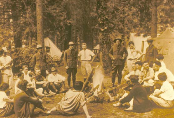
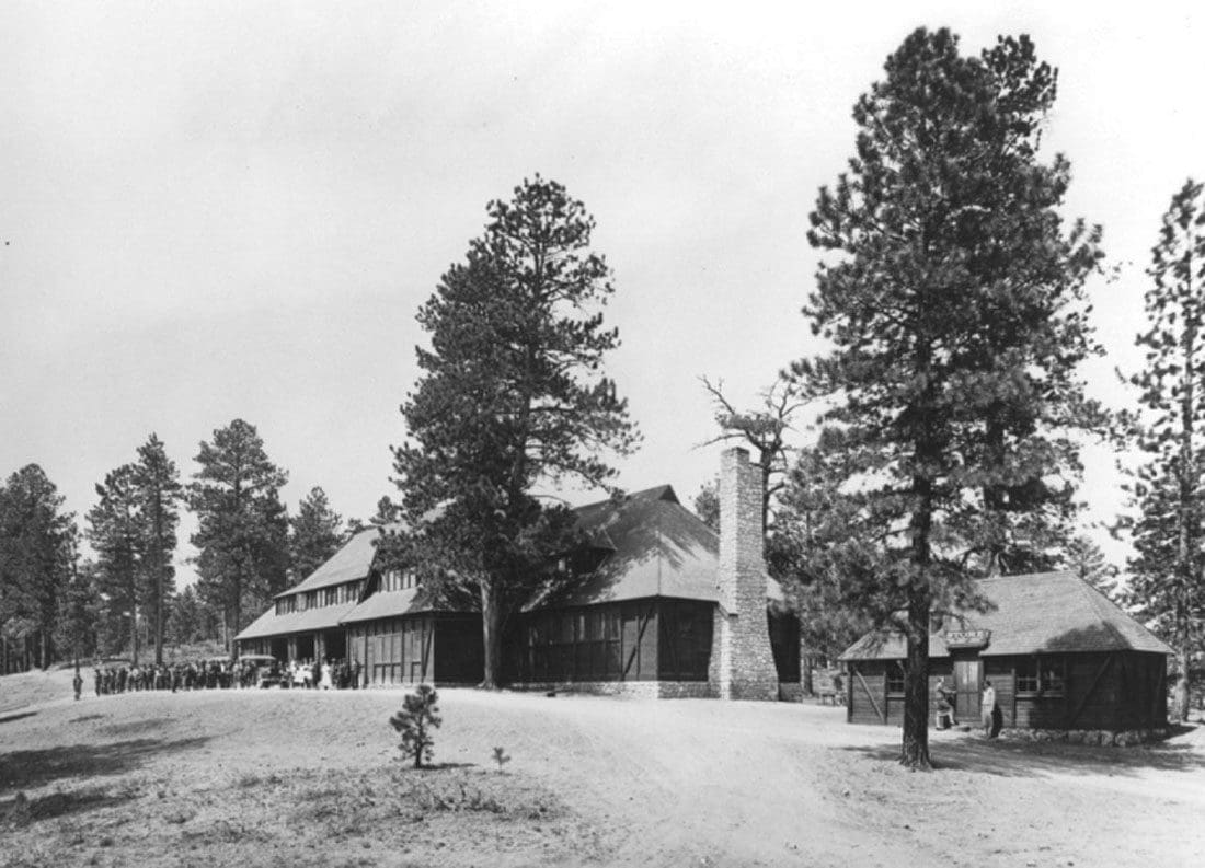
By 1919, tourists from Salt Lake City were visiting Bryce Canyon. Ruby and Minnie Syrett erected tents and supplied meals for over night guests near Sunset Point. In 1920 the Syretts constructed Tourist’s Rest a 30 by 71 foot lodge, with eight or ten nearby cabins and an open air dance floor. In 1923, the Union Pacific Railroad bought the Tourist’s Rest land, buildings and water rights from the Syretts. Ruby and Minnie established Ruby’s Inn just outside the park.1
SPONSORED ADVERTISEMENT
Gilbert Stanley Underwood was hired by the Union Pacific to design a lodge near Sunset Point. The original main building was finished by May 1925. Additions were made and the final configuration completed by 1927. The standard and deluxe cabins near the lodge were constructed between 1925 and 1929.1
President Warren G. Harding proclaimed Bryce Canyon a national monument on June 8, 1923. On June 7, 1924, Congress passed a bill to establish Utah National Park, when all land within the national monument would become the property of the United States. The land was acquired and the name was restored to Bryce Canyon. On February 25, 1928, Bryce Canyon officially became a national park.1
SPONSORED ADVERTISEMENT
Why “April 2021 – Park of the Month”?
This beautiful National Park is a favorite for many. The views alone are one of the reasons we choose this park and it is the perfect time to visit. With the winter weather subsiding and park roads reopening, the park provides access to some of natures most unique geological formations.
The park is famous for the largest collection of hoodoos in the world. While the patterns and clusters of hoodoos are aesthetically appealing and visually striking, the story of how they came to be is equally as intriguing.2
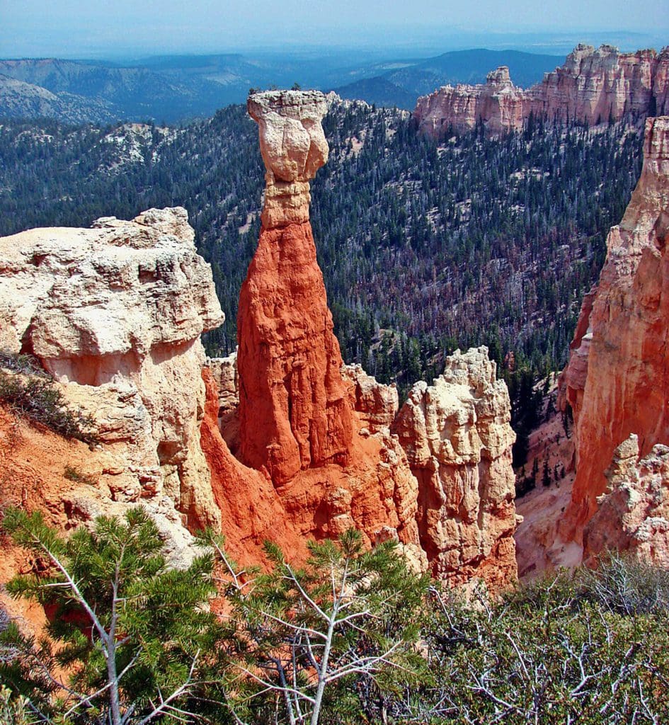
Unfortunately hoodoos don’t last very long. The same processes that create hoodoos are equally aggressive and intent on their destruction. The average rate of erosion is calculated at 2-4 feet every 100 years. So it is that Bryce Canyon, as we know it, will not always be here. As the canyon continues to erode to the west it will eventually capture (perhaps 3 million years from now) the watershed of the East Fork of the Sevier River.3
SPONSORED ADVERTISEMENT
Once this river flows through the Bryce Amphitheater it will dominate the erosional pattern, replacing hoodoos with a “V” shaped canyon and steep cliff walls typical of the weathering and erosional patterns created by flowing water. Indeed a foreshadowing of this fate can be observed in Water Canyon while hiking the Mossy Cave Trail. For over 100 years a diversion canal has been taking a portion of the East Fork of the Sevier River through this section of the park and already it’s easy to see the changes the flowing water has created.3
While we can’t stop this inevitable fate, humans can help to preserve the Park’s existing hoodoos by keeping to the park trail system. Believe it or not, just walking up to the base of a hoodoo will shorten its life span as your tracks weaken the clay slopes that protect the hoodoo’s foundations. Staying on established trails ensures that erosion will not prematurely destroy the hoodoos that millions of people come from all over the world to see.3
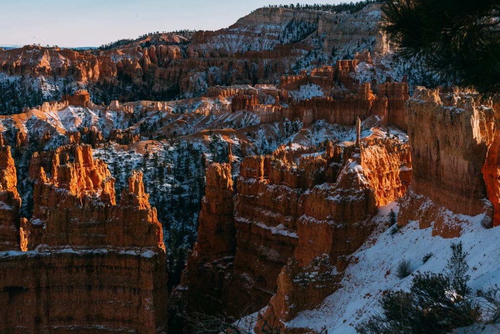
And, if you are visiting this majestic park, make sure to catch a Sunrise or Sunset from one of the many viewpoints around the Bryce Amphitheater area. Learn more about the best spots in the hiking section below!
Some of the below locations or activities are currently not available due to COVID-19 restrictions. Visit our Bryce Canyon National Park page for more information on the status of the park in the COVID-19 Information bar.
SPONSORED ADVERTISEMENT
The Scenic Drives
Not known as an official scenic drive, the Bryce Canyon Scenic Drive (the main road) offers an amazing way to see the park, not only from the drive in but through the park to all the amazing overlooks.
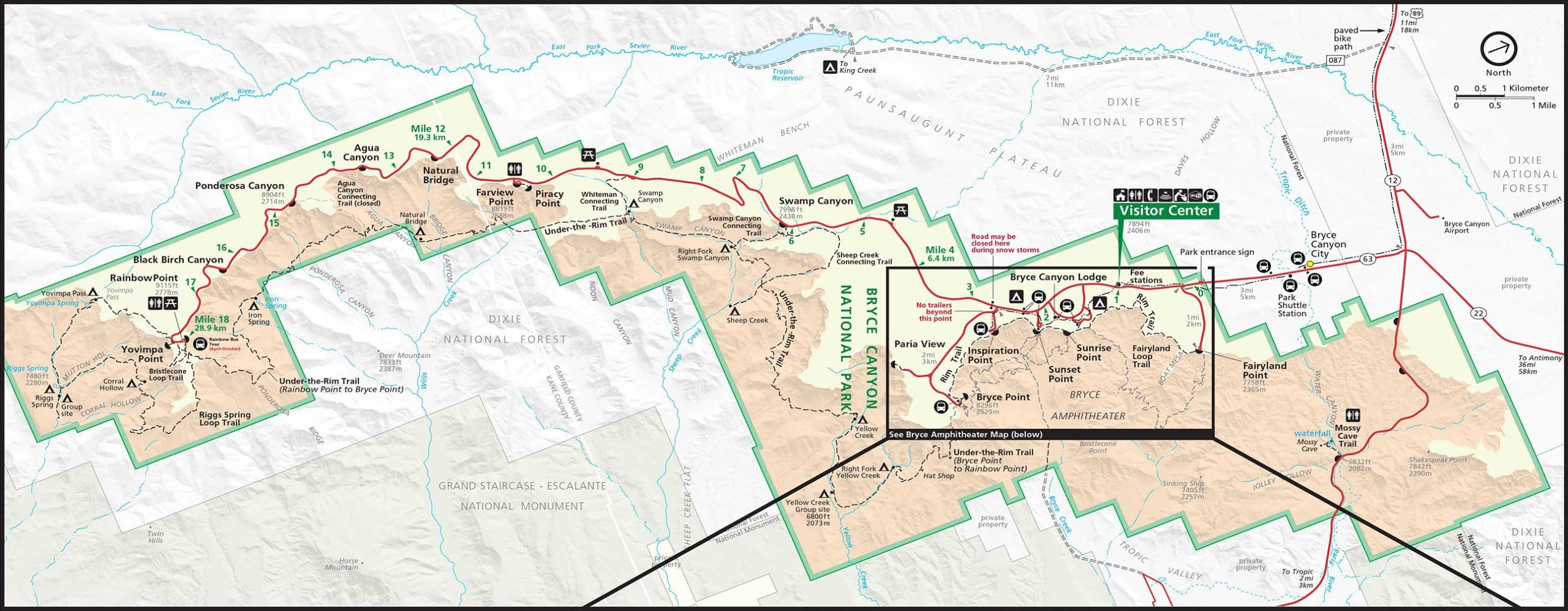
It takes a minimum of 3 hours to drive to the 13 viewpoints along the park’s 38-mile (round-trip) scenic drive. It begins when you leave Bryce Canyon City and head South on Utah 63 (the above map is turned to better see the park, but use the compass in the top right corner to get bearings if needed).
To get the entire scenic drive experience, make sure not to just stay in the Northern portion. Heading south past the Bryce Amphitheater area provides access to some of the most amazing overlooks within the park.
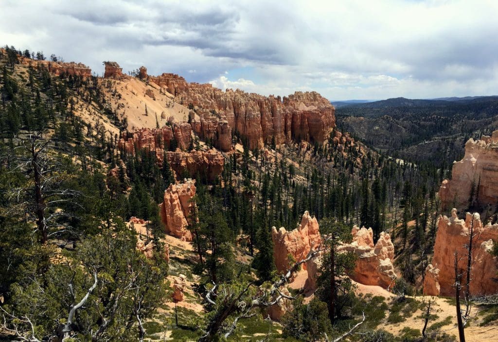
Swamp Canyon Overlook is the first of these majestic overlooks. It begins a transition from the hoodoo-filled Bryce Amphitheater to the steep cliffs and buttes that characterize the scenic drive and southern end of the park. Many people assume that Swamp Canyon must be a misnomer.4
Although it might be the last place on Earth you would expect to find an alligator, compared to the rest of the park it is a virtual wetland. Here, below the rim, two tiny creeks and a spring provide enough water to sustain more lush vegetation like grasses and willows. This canyon remains wet enough year-around that it is also home to tiger salamanders and wild iris. Bird watchers enjoy hiking the Swamp Canyon Loop Trail as it traverses four distinctly different habitats offering the chance to see a wide diversity of songbirds.4
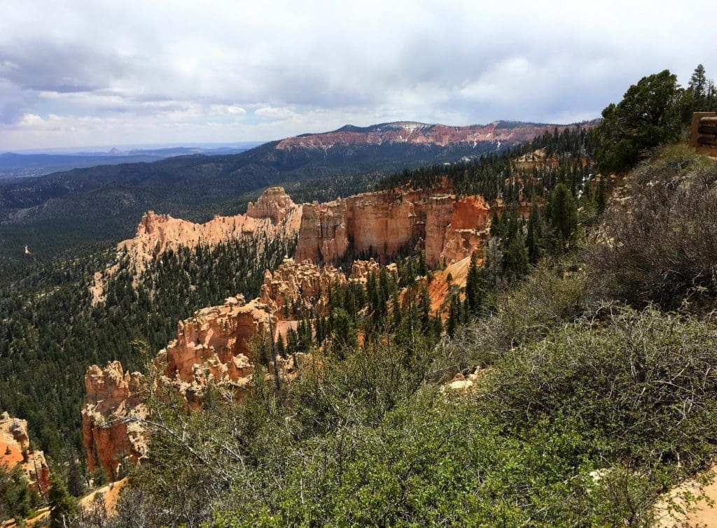
The next stop you don’t want to miss on this scenic drive is Farview Point Overlook. Farview Point is appropriately named, with spectacular views of famous landmarks that make up the Grand Staircase. These magnificent views result from Bryce Canyon’s extremely high air quality, with potential visibility as far away as the Black Mesas in Arizona — up to 160 miles! Navajo Mountain, 90 miles away on the border of Utah and Arizona, can be seen on all but the worst days. While many visitors are awed by the beautiful things they see here, it is what they don’t see (the haze and smog produced by particulates in the air) that is one of Bryce Canyon’s most valued assets.5
SPONSORED ADVERTISEMENT
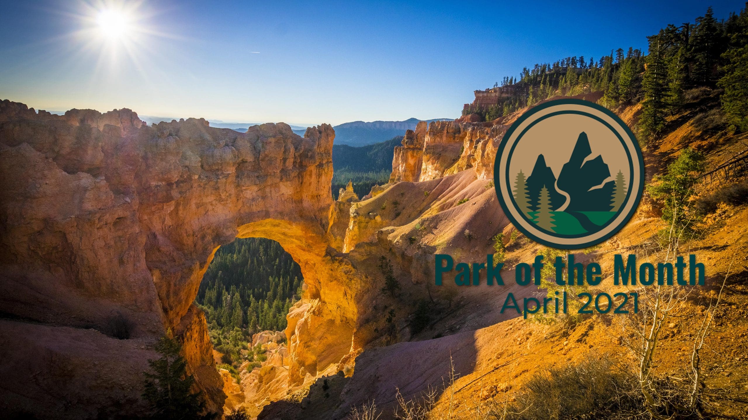
Next stop on the road that we recommend not missing is the Natural Bridge Overlook (seen in the main photo at the top of this article). Though the name tends to be misleading, Natural Bridge is one of several natural arches in Bryce Canyon and creates a beautiful scene at this viewpoint. This arch, sculpted from some of the reddest rock of the Claron Formation (rich in iron oxide minerals), poses a stark contrast to the dark green of the Ponderosa forest that peeks through the arch from the canyon below.6
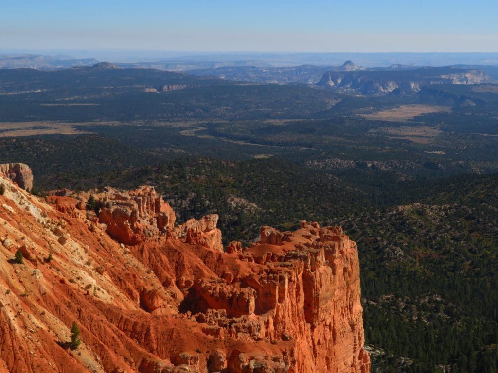
Our last can’t miss overlook is the end of the road for this scenic drive at Yovimpa Point Overlook. Yovimpa Point is one of the highest viewpoints in the park. Tectonic uplift has lifted this entire scene from sea-level over the course of the last 20 million years to later be dissected by tributaries of the Colorado River. Tilting that occurred during uplift has situated the southern end of the park approximately 1,000ft higher than its northern end. Here you can gaze from the southern tip of the Paunsaugunt plateau and overlook the colorful cliffs of the Grand Staircase.7
Although there are plenty of viewpoints not mentioned here, if you are planning to visit, we suggest getting out and seeing the park away from the road because it is just a starter to the vast beauty and wildness of our April 2021 – Park of the Month.
For more information on the Bryce Canyon Scenic Drive, we suggest taking a look at this interactive park map from NPS here, clicking on viewpoints and other points of interest will lead you to more information about the area or point of interest.
SPONSORED ADVERTISEMENT
Hiking
Bryce Canyon National Park, our April 2021 – Park of the Month, has numerous wonderful hikes for the laidback easy hikers to the adventurous backcountry hike. Below are our suggestions for some amazing hiking!
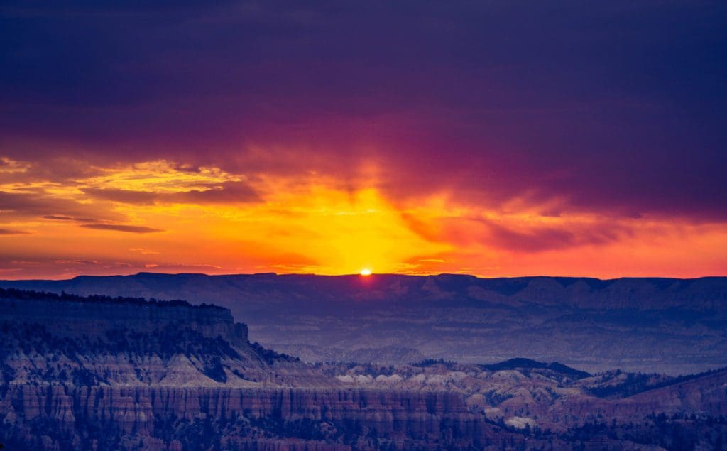
Our first suggestion is the Sunset Point to Sunrise Point & Rim Trail. The section between Sunrise and Sunset Points, 1 mile round-trip, is paved and has minor elevation changes. The path is wheelchair accessible except in severe weather. This is the only section of the Rim Trail pets are allowed on. The rest of the Rim Trail extending from Fairyland Point to Bryce Point has several steep elevation changes and is a 5.5 mile, 1-7.5 hour, one-way hike (depending on what routes you choose). The Rim Trail offers hikers the opportunity to see the Main Amphitheater from above. This is one of the more popular trails in the entire park and can be crowded during busier seasons.8
For more information about these hikes and a map of these trails, check out the NPS page here.
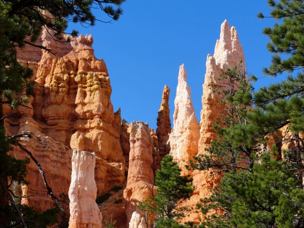
Our second suggestion is a more moderate hike and combines two trails into one and is known as the Queens Garden & Navajo Combination hike, roughly a 2.9 mile, 2-3 hour, round-trip hike. THIS IS THE MOST POPULAR HIKE IN THE PARK!!!
The loop is created by combining the Queen’s Garden Trail (which descends from Sunrise Point) with the Navajo Loop Trail (which descends from Sunset Point). It is recommended hiking this loop in a clockwise direction: going down the Queen’s Garden Trail and up the Navajo Loop Trail.9
The reason for this is threefold: first, the Queen’s Garden Trail provides much wider views of the Bryce Amphitheater, and by choosing to descend it you can enjoy these views out in front of you (rather than losing them over your shoulder as you trudge upwards). Second, the Queen’s Garden is less steep than the Navajo Loop, making descents safer (most injuries happen on the way down a trail). Finally, it’s nice to have everyone hiking in the same direction, which can help the trail to feel less busy.9
For a sense of both sides of the Navajo Loop (if the Wall Street side is open), you might consider heading up the Wall Street side and then descending the Two Bridges side just far enough to see Thor’s Hammer.9
For more information about this hike and a map of these trails, check out the NPS page here.
SPONSORED ADVERTISEMENT
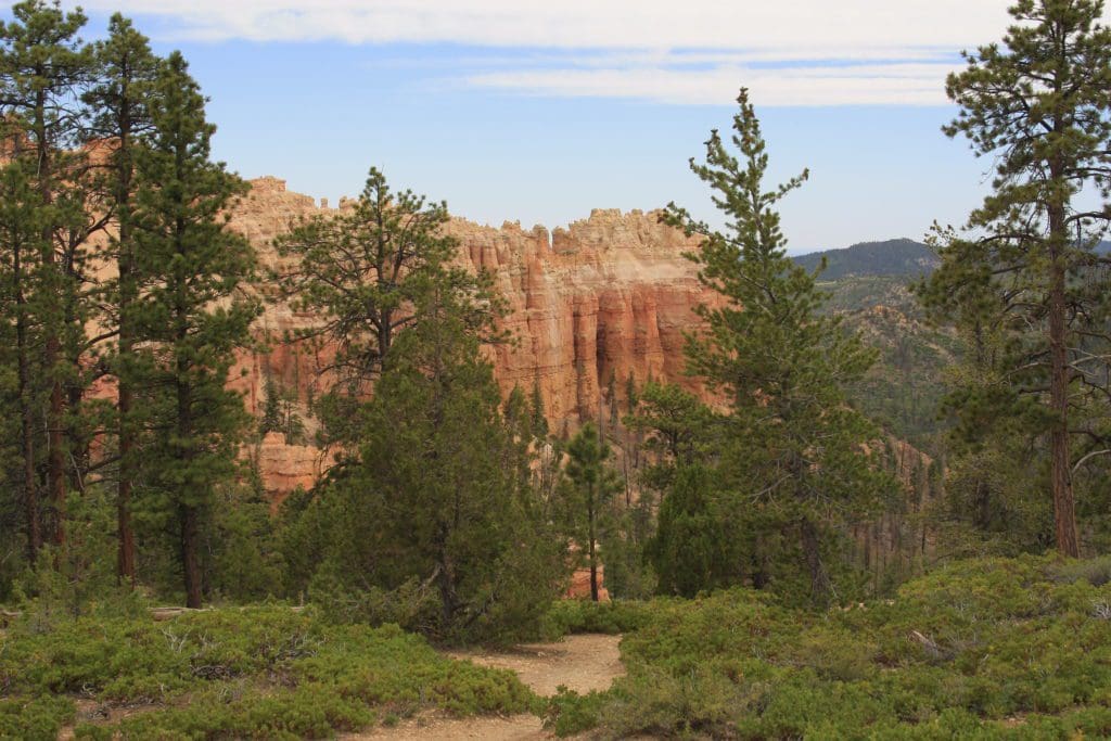
Our next suggestion, is the Sheep Creek/Swamp Canyon hike. This moderate 4 mile, 3-4 hour, hike is in a more remote part of the park and is less crowded during the busier seasons. Swamp Canyon appears relatively small and sheltered from the overlook, bounded on both sides by fins and hoodoos. This size allows the viewer to develop a more intimate connection with the landscape than some of the grander viewpoints may provide. From the Swamp Canyon overlook, hikers can descend to either side of the prominence on a trail that will connect with the Under the Rim Trail and then return on the other side, making a loop. It is recommended to do this in a clockwise direction.10
Though a moderate hike, this trail can be difficult if not prepared.
For more information about this hike and a map of these trails, check out the NPS page here.
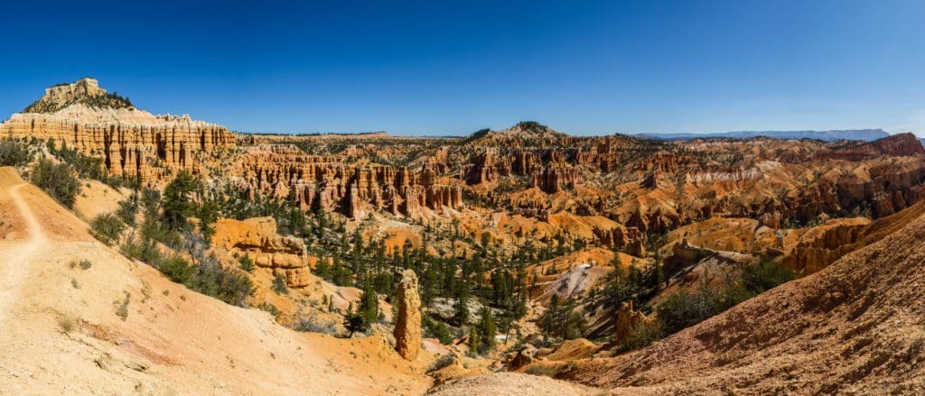
Our final suggestion is the Fairyland Loop hike. This 8 mile, 4-5 hour, strenuous hike begins at Fairyland Point, at the northern portion of the park, and takes you through spectacular hoodoos and scenery along the rim and into the canyon; including a spur trail to Tower Bridge. This hike is considered strenuous due to its length and meandering trails with multiple elevation changes. The Fairyland Loop Trail also includes a portion of the Rim Trail from Sunset Point to Fairyland Point.11
This trail provides an amazing perspective of the geology of the park. Walking in certain sections provides a canopy like sense of the towering hoodoos above. The colors of the amazing rock formations a particularly potent on this hike. For views of the fascinating geology, you could add on a spur to Tower Bridge.
For more information about this hike and a map of these trails, check out the NPS page here.
For more amazing hiking trails, we totally recommend grabbing a copy of
Hiking Zion and Bryce Canyon National Parks: A Guide To Southwestern Utah’s Greatest Hikes (Regional Hiking Series):
SPONSORED ADVERTISEMENT
Camping & Lodging
Our April 2021 – Park of the Month pick has numerous options for staying overnight within the park. From a lodge, to campgrounds and backcountry trips, this park is made for an adventure!
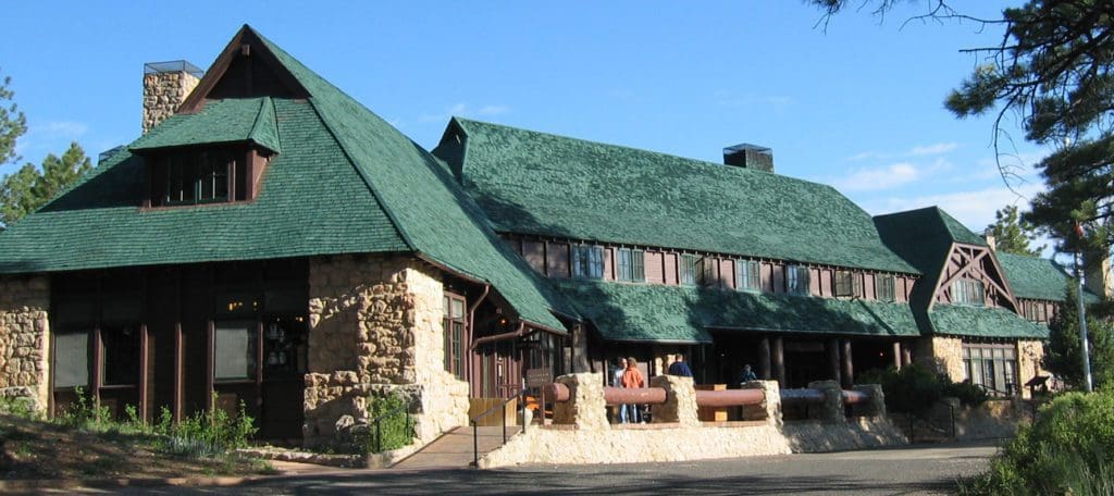
If you like a little luxury when you visit the wild of the National Parks, the Bryce Canyon Lodge is perfect for you. The Lodge at Bryce Canyon is one of the park’s most iconic historic structures. The Lodge and its surrounding motel structures are located a short walk from the park’s iconic Bryce Amphitheater, and offer 114 rooms including lodge suites, motel rooms, and cabins. Reservations are highly recommended. The dining room at Bryce Canyon Lodge is open for breakfast, lunch and dinner. A gift shop is available at the Lodge.12
For more information about Bryce Canyon Lodge and to make reservations, check out the Bryce Canyon Lodge website here.
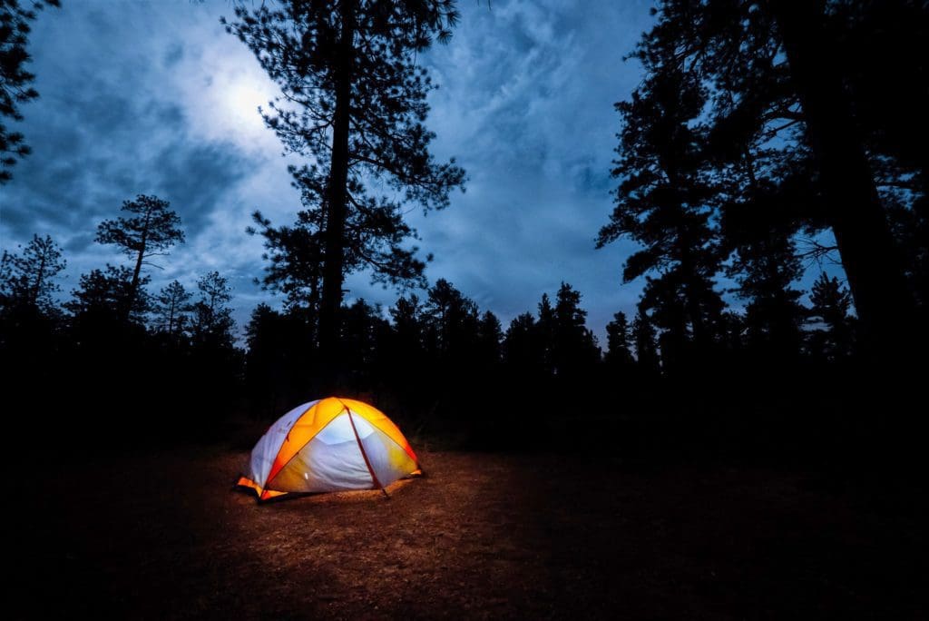
Bryce Canyon has two campgrounds to choose from within the park, depending on what time of year you go.
Open year-round, the North Campground is located across the road to the east of the Bryce Canyon Visitor Center and is comprised of 99 sites in 4 loops; A, B, C, D. Loops A & B are for RV campers. Loops C & D are for tent campers.
There are no sewer, water or electrical hook-ups available. North Campground is close to the Visitor Center, General Store, and Fairyland Loop/Rim Trail.13
For more information on North Campground, check out the Discover Our Parks page about it here and the NPS page here.
The second campground, Sunset Campground is located west of Sunset Point, approximately 1.5 miles south of the Bryce Canyon Visitor Center, and is comprised of 100 sites in 3 loops; A, B, & C. Loop A is for RV campers. Loops B & C are for tent campers. There are no sewer, water or electrical hook-ups available. Sunset Campground is close to Sunset Point and has a shuttle stop at its entrance.14
For more information on Sunset Campground, check out the Discover Our Parks page about it here and the NPS page here.
Are you looking to visit other parks in the area around Bryce Canyon National Park? If so, check out this great guide to help you find the best campgrounds and areas to visit:
A Complete Guide to the Grand Circle National Parks: Covering Zion, Bryce Canyon, Capitol Reef, Arches, Canyonlands, Mesa Verde, and Grand Canyon National Parks
SPONSORED ADVERTISEMENT
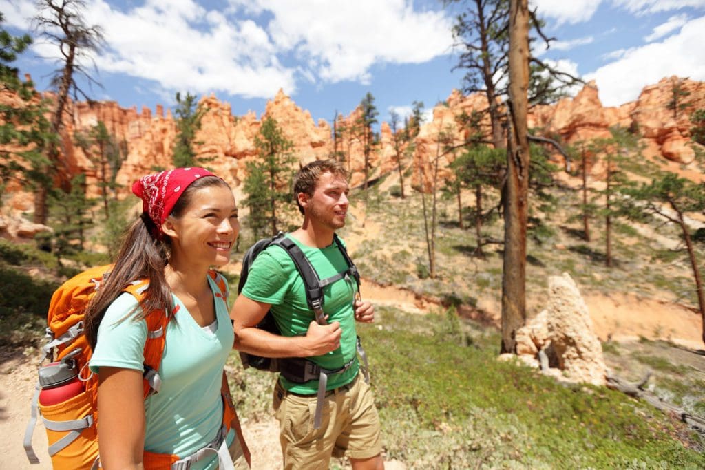
If you are looking for an adventure filled, multi day trip, backpacking might be your best option to explore the park!
Experience the solitude of Bryce’s forested backcountry on the Under the Rim Trail. Descending from the rim, this 22.9 mile trail meanders through forests & meadows, offering stunning views of rainbow-hued cliffs in the distance. The Under the Rim Trail follows the base of the Paunsaugant Plateau and is largely forested. The hoodoos are part of the distant vistas to the west as you hike the valley floor.15
If you are planning a backpacking trip, remember backcountry camping is only permitted in designated campsites (there are a total of 10). Make sure to get a Backcountry Permit at the Visitor Center if you plan to do this and always share your plans with others, incase of an emergency.
For more information on backcountry hiking and camping, check out the NPS Backcountry Camping page here.
For more information about Bryce Canyon National Park, our April 2021 – Park of the Month, and to plan your trip, visit our park page, which includes specific information about the park status in regards to COVID-19. Be sure to check out the more detailed About the Park page with great information from the park.
Remember when visiting any National Park, whether camping, hiking or just visiting a visitors center, always do your part and follow the Leave No Trace principles to help protect the park. Learn more here!
Have you been to Bryce Canyon National Park or have a comment regarding our choice? Let us know below in the comments section.
Help support Discover Our Parks by becoming a Patron for as little as $1 a month! Your support will help us continue to provide articles like this and add even more information about our parks to this site.
If you want to make a one-time donation, buy us a coffee!
‘We got some of the above information from the following:
1: NPS – Bryce Canyon NP – Park History
2: NPS – Bryce Canyon NP – Geologic Formations
3: NPS – Bryce Canyon NP – Protect the Hoodoos
4: NPS – Bryce Canyon NP – Places – Swamp Canyon
5: NPS – Bryce Canyon NP – Farview
6: NPS – Bryce Canyon NP – Natural Bridge
7: NPS – Bryce Canyon NP – Yovimpa Point
8: NPS – Bryce Canyon NP – Rim Trail
9: NPS – Bryce Canyon NP – Queens Garden & Navajo Combination
10: NPS – Bryce Canyon NP – Swamp Canyon Trail
11: NPS – Bryce Canyon NP – Fairyland Loop
12: NPS – Bryce Canyon NP – Lodging
13: NPS – Bryce Canyon NP – North Campground
14: NPS – Bryce Canyon NP – Sunset Campground
15: NPS – Bryce Canyon NP – Backcountry Information
Check out these recent posts from Discover Our Parks:
- The Isolated Black-bellied Salamander: Wildlife of the Week – 2023 Week 22
- The Splendid Sandhill Crane: Wildlife of the Week – 2023 Week 21
- The Promising Peregrine Falcon: Wildlife of the Week – 2023 Week 20
- The Intimidating Killer Whale: Wildlife of the Week – 2023 Week 19
- The Swift Fox: Wildlife of the Week – 2023 Week 18
SPONSORED ADVERTISEMENT


What a beautiful place, we visited and enjoyed ourselves. From North Carolina!